

One of the best ways to discover Gerês is to leave the road behind and start walking.
You don’t need to be an experienced hiker or spend several days crossing the mountains. There are trails that are very different from one another — some shorter, others more demanding, some focused on landscapes, others on history and villages — allowing you to discover different sides of Peneda-Gerês National Park.
And perhaps that is one of the best things about hiking in Gerês: there is no single way to experience it.
You can walk alongside rivers and waterfalls, cross ancient forests, climb granite slopes, pass through mountain villages or follow paths that have been used for generations by shepherds and local communities.
So, rather than simply looking for “the best trail”, we have brought together routes with different characteristics. The idea is for you to find the trail that best suits your trip, your level of fitness and the people travelling with you.
1. Ermida to Fafião — Mountain Landscapes, Rivers & Old Shepherd Paths
Distance: 9.4 km
Duration: around 4 hours
Official difficulty: Somewhat difficult
If you’re looking for a hike that brings together many of the elements that make Gerês distinctive, Ermida–Fafião is an excellent choice.
Part of the GR50, this route connects the mountain villages of Ermida and Fafião along ancient shepherds’ paths. Along the way, you cross the Arado, Conho and Fafião rivers and pass through forests, granite formations, viewpoints and places connected to the traditional way of life of the mountain communities.
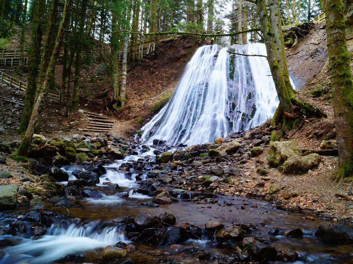
One of the most interesting moments comes alongside the Arado River, where the trail passes the Rajada Bridge and Waterfall. Further on, you’ll find the Silhas viewpoints, granite formations, the Tribela mixed woodland and Curral de Pinhô.
The route ends near the Fafião Wolf Trap, a traditional structure associated with historical methods of protecting livestock from wolves.
It is a hike where nature, history and rural life are constantly intertwined.
At a glance
Difficulty: 🟠 Somewhat difficult
Duration: ⏱️ ~4 hours
Terrain: ⛰️ Uphill and downhill sections, mountain terrain and rocky areas
Ideal for: 👥 Friends / hikers with some experience
Family: ⚠️ Not the best option for young children
Pet: ⚠️ Possible for dogs accustomed to hiking, but the terrain and elevation changes require care
Highlights: 🌊 Arado River · Rajada Waterfall · Wolf Trap · mountain landscapes
If you like: a hike that makes you feel truly immersed in the mountains.
2. Brufe to Campo do Gerês — Mountains, Villages & Vilarinho das Furnas
Distance: 11.3 km
Duration: around 4h30
Official difficulty: Somewhat difficult
Another section of the GR50 connects Brufe and Campo do Gerês, crossing the landscape between the Amarela and Gerês mountain ranges.
The route passes through Carvalheira and Bom Jesus das Mós, following the landscape of the Homem River valley and the Vilarinho das Furnas reservoir. It also crosses the Homem River near the medieval Quintão Bridge.
This is a particularly interesting hike for anyone who wants to understand that Gerês is not just about forests and wild mountains.
The landscape has also been shaped by the people who live — and have lived — in these mountains.
Agricultural fields, villages, ancient paths and mountains all form part of the same landscape.
At a glance
Difficulty: 🟠 Somewhat difficult
Duration: ⏱️ ~4h30
Terrain: ⛰️ Uphill and downhill sections; significant elevation change
Ideal for: 👥 Friends / hikers accustomed to several-hour walks
Family: ⚠️ Suitable only for families with children accustomed to hiking
Pet: ⚠️ Possible for dogs prepared for the distance and elevation change
Highlights: 🏘️ Villages · Vilarinho das Furnas · Homem River · rural landscapes
If you like: nature, but also want to understand the relationship between the mountains and the communities that live in them.
3. Campo do Gerês to Gerês — Ancient Paths into the Mountains
Distance: 10.3 km
Duration: around 4 hours
Official difficulty: Difficult
This trail is for anyone who really wants to experience the mountains.
The hike connects Campo do Gerês with Vila do Gerês along ancient paths once used by local communities to access the resources of the mountains. The route climbs towards Junceda, reaching around 958 metres in elevation before beginning its descent towards the village.
It is important not to look only at the 10 kilometres of distance.
Here, elevation gain and loss are a major part of the challenge, with around 1,198 metres of cumulative elevation change due to the repeated climbs and descents.
At the beginning of the route, you will also find a Roman milestone, adding a historical dimension to the hike.
At a glance
Difficulty: 🔴 Difficult
Duration: ⏱️ ~4 hours
Terrain: ⛰️ Significant uphill and downhill sections; mountain terrain
Ideal for: 🥾 Experienced hikers
Family: ❌ Not recommended for young children
Pet: ⚠️ Only for dogs very accustomed to mountain hiking
Highlights: 🌄 Junceda · high-altitude landscapes · ancient paths · Roman remains
If you like: a genuine physical challenge and hiking at higher elevations.
4. Castro Laboreiro to Lamas de Mouro — The Northern Mountains
Distance: 7 km
Duration: around 2h30
Official difficulty: Somewhat difficult
To discover a different part of the National Park, it is worth heading north.
The route between Castro Laboreiro and Lamas de Mouro begins in the centre of Castro Laboreiro and follows ancient paths that once connected the village with other settlements in the region.
This area has a very distinct identity.
The mountain landscape is deeply connected to the traditional ways of life of local communities, including the seasonal use of brandas and inverneiras — traditional settlements associated with seasonal movement between higher and lower ground.
Along the way, you will find Ponte das Veigas, woodland and wetland areas before reaching Lamas de Mouro.
At 7 kilometres, it is shorter than some of the other hikes in this selection, but it should not be mistaken for a completely flat walk.
At a glance
Difficulty: 🟠 Somewhat difficult
Duration: ⏱️ ~2h30
Terrain: 🌲 Moderate uphill and downhill sections
Ideal for: 👥 Friends / hikers looking for a shorter hike
Family: ⚠️ Possible for families with children accustomed to walking
Pet: ⚠️ Possible for dogs accustomed to mountain terrain
Highlights: 🏘️ Castro Laboreiro · Ponte das Veigas · forests · brandas and inverneiras
If you like: discovering a side of Gerês that is less associated with its better-known tourist areas.
5. Outeiro to Pitões das Júnias — Oak Woods & Mountain Villages
Distance: 9 km
Duration: around 3h30
Official difficulty: Somewhat difficult
At the eastern edge of the Park, you’ll find a trail that combines nature and culture in a particularly interesting way.
The section between Outeiro and Pitões das Júnias crosses the Beredo valley, passing through areas of oak woodland with the Gerês mountains as a backdrop.
One of the most interesting moments comes as the trail approaches the Pitões das Júnias Waterfall viewpoint.
The path then continues towards the village, crossing the agricultural fields surrounding Pitões das Júnias.
Here, the mountains are not separate from human life.
The village, fields, forests and slopes all form part of the same landscape.
At a glance
Difficulty: 🟠 Somewhat difficult
Duration: ⏱️ ~3h30
Terrain: 🌲 Moderate uphill and downhill sections
Ideal for: 👥 Friends / hikers who enjoy nature and villages
Family: ⚠️ Possible for families with children accustomed to hiking
Pet: ⚠️ Possible for dogs prepared for several hours of walking
Highlights: 🌳 Oak woodlands · waterfall · Pitões das Júnias · agricultural landscapes
If you like: combining nature, traditional villages and rural landscapes.
6. Portela do Homem — Mata de Albergaria, River & Roman Road
Not every hike in Gerês needs to take four or five hours.
And this is precisely the kind of route we want to include when talking about Gerês for all kinds of travellers.
Starting at Portela do Homem, near the Spanish border, there is a shorter route through Mata de Albergaria that combines forest, water and Roman heritage without requiring a long mountain hike.
One of the circular variants described for this area is around 4.5 km long and passes through Mata de Albergaria, Ponte de São Miguel, areas of waterfalls and natural pools, as well as approximately two kilometres of the ancient Roman Geira. It is classified as easy by route sources and is considered a suitable option for families and people who are just beginning to hike.
This is also where we realise something important about Gerês: you don’t have to climb a mountain to have a memorable experience.
You can walk among ancient oak trees, listen to the Homem River, cross a wooden bridge and follow a Roman road that is almost two thousand years old.
And if you’re travelling with children or people who do not hike regularly, you can also choose to walk only part of the route, reach the river and return the same way rather than completing the entire trail.
This is one of the best ways to adapt Gerês to your own pace.
At a glance
Difficulty: 🟢 Easy
Duration: ⏱️ ~1h30–2h for the shorter variant; you can adapt it by walking only part of the route
Terrain: 🌲 Relatively gentle, without the demanding climbs found on the longer mountain trails
Ideal for: 👨👩👧👦 Families · beginners · travellers looking for a relaxed walk
Pet: 🐕 May be an option, provided applicable local rules are respected and the animal is kept under control
Highlights: 🌳 Mata de Albergaria · Homem River · Ponte de São Miguel · Roman Geira · waterfalls and natural pools
If you like: nature without major physical challenges and the flexibility to adapt the distance to your group.
Note: This hike should not be confused with the GR50 stages. Some local variants are not fully signposted, so it is especially important to use a map or GPS track before setting off.
Which Trail Is Right for You?
There is no single perfect trail for everyone.
Gerês can be an adventure for experienced hikers, but it can also be explored by families, groups of friends and people who simply want to spend a few hours surrounded by nature.
🥾 If you want a challenge
Campo do Gerês → Gerês
The most demanding option in this selection, with significant elevation gain and loss.
🌊 If you want a complete mountain experience
Ermida → Fafião
Rivers, waterfall, forest, rock formations, history and mountain landscapes.
🏘️ If you want to combine nature and villages
Outeiro → Pitões das Júnias
or
Brufe → Campo do Gerês
🌲 If you want a more relaxed hike
Portela do Homem → Mata de Albergaria
The most accessible option in this selection, with the possibility of adapting the distance to the abilities of your group.
👨👩👧👦 If you’re travelling with family
Start with a shorter walk such as the one through Mata de Albergaria and adapt the route to the children’s pace.
You don’t need to walk 10 kilometres to say you’ve “done a trail in Gerês”.
🐕 If you’re travelling with your dog
Choose a route according to your dog’s fitness and experience, carry enough water and keep your dog under control at all times. Before setting off, also check the specific rules that apply to the trail and protected area.
Wildlife on the Trail
One of the most special things about hiking in Gerês is knowing that we are not alone.
The National Park has extraordinary biodiversity, with species such as roe deer, garranos, otters, Pyrenean desmans, Iberian water lizards, golden-striped salamanders, numerous bird species and the Iberian wolf. The ICNF currently identifies 235 vertebrate species, 204 of which are protected at national or international level.
But encountering a wild animal should be a privilege, not an opportunity to chase it.
If you come across a garrano, roe deer, bird of prey or any other wild animal:
stop, observe and let it go on its way.
Do not try to get closer for a better photograph.
Do not make noise to attract its attention.
Do not feed wild animals.
And if you are hiking with a dog, take particular care to ensure that it does not chase wildlife.
Nature was here before us.
And it should still be here after us.
Respecting it is not simply a visitor rule. It is the least we can do for a place that supports so much life.
Before You Set Off
A hike in Gerês can begin as a pleasant walk and quickly become a demanding situation if the weather changes, you lose the trail or underestimate how long you will need to get back.
So plan your hike according to your ability and the amount of daylight available.
Don’t choose a four-hour trail and set off at three in the afternoon simply because “it’s still sunny”.
Allow time for breaks, photographs, unexpected difficulties and possible detours.
What to Have Before You Set Off
📱 Phone: leave with a fully charged battery.
🔋 Power bank: especially important on longer routes or in areas without mobile coverage.
🧭 Compass: it may seem old-fashioned, but it remains a simple and useful tool if digital navigation fails.
🗺️ Map / GPS: download the route in advance whenever possible.
💧 Water and food: some routes have no supply points at all.
🥾 Suitable footwear: the terrain can be rocky, uneven and slippery.
🧥 Appropriate clothing: mountain weather can change quickly.
🌦️ Weather: check the forecast before setting off.
🔥 Fire risk: check current conditions and any restrictions.
🌙 Daylight: always plan to finish your hike before nightfall.
The GR50 recommends checking weather conditions and fire risk, using appropriate equipment, carrying enough food and water and avoiding setting out in adverse weather conditions.
Learn the GR50 Signs
If you are hiking a GR50 stage, learn to recognise the trail markings before you begin.
The Great Route markings are red and white and may appear on rocks, trees or other elements along the route.
The standard trail marking consists of two horizontal bars, white on top and red underneath.
When the trail changes direction, the same colour combination is used to indicate which way to go.
And there is one marking you should recognise immediately: a red and white X means you are on the wrong path.
In addition to painted markings, the GR50 has its own vertical signage, with posts and markers identified by a numerical code.
This detail is particularly important.
If you have a problem, get lost or need assistance, this code can help authorities identify your location.
The GR50 also provides an official free app for Android and iOS, with information about routes, tracks, points of interest, services and alerts. The app allows you to check in before starting each stage and includes a “Request Help” function that can transmit your location coordinates to 112, the European emergency number.
Before starting a GR50 stage:
1. Fully charge your phone.
2. Open the app and download/check the route.
3. Check in.
4. Save 112 for emergencies.
5. Pay attention to the marker codes along the route.
6. Carry a power bank.
7. Do not rely solely on your phone — a compass and map can be useful if something goes wrong.
The GR50 organisation itself emphasises that the hiker’s safety and protection depend largely on their own preparation and self-sufficiency.
Respect the Mountain
Gerês is not a landscape created for us.
It is a protected territory, with ancient forests, rivers, rare habitats and hundreds of species that depend on the tranquillity of these mountains.
So hike with respect.
Do not leave rubbish behind.
Do not take plants, rocks or other natural elements as souvenirs.
Do not make unnecessary noise.
Do not try to approach wild animals.
Do not feed wildlife.
Do not leave the trails without good reason.
And, above all, remember that nature is not simply what we came here to visit — it is what makes all the life we know possible.
If we want to continue finding wildlife, clean rivers, forests and untouched landscapes in the future, we must learn how to visit these places without consuming them.
Nature is the mother of everything we create. And in Gerês, perhaps it is impossible not to feel that.
More Gerês Trails
The trails featured here are only a small selection of what can be explored in Peneda-Gerês National Park.
You don’t need to do them all.
Choose the one that suits your group, the time you have available and your level of fitness.
And remember: a good hike is not the one that takes you the furthest. It is the one where you return safely, carrying good memories with you and leaving the mountain exactly as you found it.
P.S. — Hiking with Dogs, Children & Communication
Hiking with your dog?
Trails can be adapted to dogs, but it is essential to know the animal you are bringing with you.
If your dog is accustomed to hiking in the mountains, is comfortable in woodland environments and reliably responds to recall, they may adapt very well to different routes.
But if your dog is not well trained, not used to forests or mountains, very curious, reactive or uncomfortable around other animals, they should remain on a leash.
This is particularly important in Gerês because you may encounter other dogs, people and wildlife. If your dog spots a roe deer, garrano or another animal and tends to chase it, they should not be allowed off leash.
Know your dog and choose a level of freedom that you can safely control.
Travelling with Children & Older Adults
The same principle applies to the people in your group.
Not all trails are suitable for young children or people with reduced mobility. Some routes have loose rocks, uneven terrain, steep elevation changes, slippery areas and sections alongside rivers and waterfalls.
If you are travelling with children, choose a route appropriate for their age and abilities. For very young children, a long mountain hike or a route with significant elevation gain can turn a beautiful experience into a tiring and potentially dangerous situation.
The same applies to older adults: age itself is not the deciding factor — mobility, balance, physical endurance and experience with mountain hiking are.
An older person who is accustomed to hiking and comfortable on mountain terrain may be perfectly capable of completing routes that would be unsuitable for someone with limited mobility or little experience.
Before choosing a trail, be realistic about the abilities of every person — and animal — in your group.
There is nothing wrong with choosing a shorter and easier route. The goal is to enjoy Gerês, not to prove that you can complete the most difficult trail.
A Final Note for International Visitors
If you are visiting Portugal from another country, we strongly recommend having a translation app on your phone, preferably one with Portuguese voice translation.
Not everyone you encounter along the way will speak English or other widely spoken international languages. Being able to communicate in Portuguese can be particularly important in an emergency, when asking for directions or when explaining exactly where you are and what has happened.
Before entering the mountains, make sure your phone is charged, that your translation app is available and, if possible, that Portuguese has been downloaded for offline use.
Prepare before you enter the mountains. Once you’re out there, you may not always have mobile coverage, immediate help or someone who speaks your language.